
Phones have become a ubiquitous part of nearly everyone’s lives. They allow for instant communication, quick photography, and simple navigation which are almost always essential tools for study abroad experiences. A phone’s versatility and omnipresence often makes it difficult to live without. While I walked along streets in Rome, I would find myself drawn back to my phone’s screen to answer a plethora of questions. Was I going the right way? What church is that? What exactly is lampredotto? (This one is a terrific sandwich I discovered thanks to a Stanley Tucci recommendation in Florence). It felt difficult to peel myself away from my phone at times due to these questions and the, at times, overwhelming amount of information presented to me at a time.

Having my phone led me to some great experiences such as trying the lampredotto sandwich and countless other terrific meals across the streets of Rome. I was able to experience and find so many unique and wonderful museums and learn about streets and churches that I was on in real time. But my phone also hindered my experience of taking in the city as it was around me and not just digitally reconstructed on my phone. I wanted to ensure that I was able to see as much of the city as possible without having my attention pulled to my phone screen.
I took many walks throughout the city. My architecture professor Dr. Morton had one of our assignments be to physically map our walks throughout the city on a paper map he provided to my classmates and I. This was inspired by a similar “Mapping Activity” that Dr. Morton’s professor gave to him when he was an undergrad studying abroad in Rome. I was inspired by this assignment and wanted to expand my walks even further throughout the city.
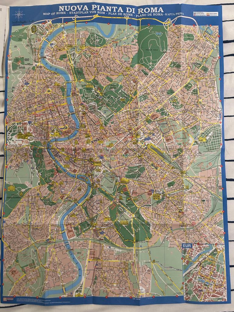
On our maps, the bottom right section was covered in a large greenspace with roads leading into it and two labelled structures for churches. This area peaked my interest as it seemed large to have such a large greenspace close to the hustle and bustle of inner-city Rome. I decided to walk to this area which I learned was part of the Regional Park of the Appian Way, a massive archaeological park with thousands of Roman ruins. On this walk, I chose to forgo my phone.
In putting my phone away in my backpack, I became much more aware of what was around me. Even before getting to the Appian Way, the ruins of the Circus Maximus, Baths of Caracalla, and Aurelian Walls grabbed my attention much more than they had when I was following the blue line of Google Maps on my phone. A very helpful thing about doing this type of phone-free exploration is that I was much more focused on stopping to read. Italy and especially Rome is full of informational signage often in both Italian and English. This greatly helped me understand and overcome language barriers that I have due to my limited Italian language skills. This stopping to read made me intentionally hone in on and remember information about my walk. I stopped in the Church of Quo Vadis and read the informational pamphlets regarding the Via Francigena, a massive pilgrimage route from Canterbury, England, through France and Switzerland, to Rome, and down to the heel of Italy.

I felt far more comfortable in my phone-free walk than in any I had with my phone. Without having to constantly check my phone, I was more able to freely explore down any side path, stop at any archaeological site, or look out over the fields and streams rather than feeling the pressure of following directions when navigating. I think it was great to be able to take away a helpful tool if an unintended barrier to exploration that is my phone.